
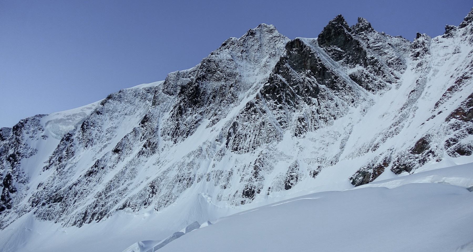
Grossglockner Mayerl Ramp
- 10 hWalking time
- 2050 mAscent
- 14 kmDistance
- 3798 mHighest point
- Kals - StüdlhütteAccommodation
- 5/5 Difficulty
-
 Nationalpark Hohe Tauern
Tour description
There are a couple different ways to reach the base of the route, depending on conditions, but the most common one we will describe here.
On the first day we drive through Heiligenblut in Carinthia and further up to the parking at the Franz Josefs Hoehe. After a steep descent we cross the Pasterze glacier and up through moraines and more crevassed glacier travel we should reach the Glockner Biwak (3205m) in about 6h. A big and serious approach!
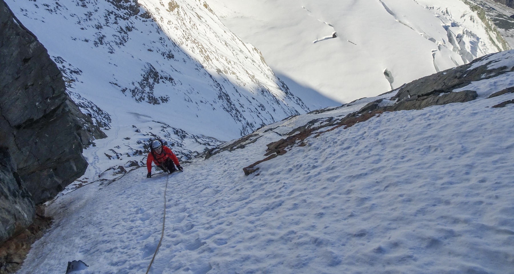
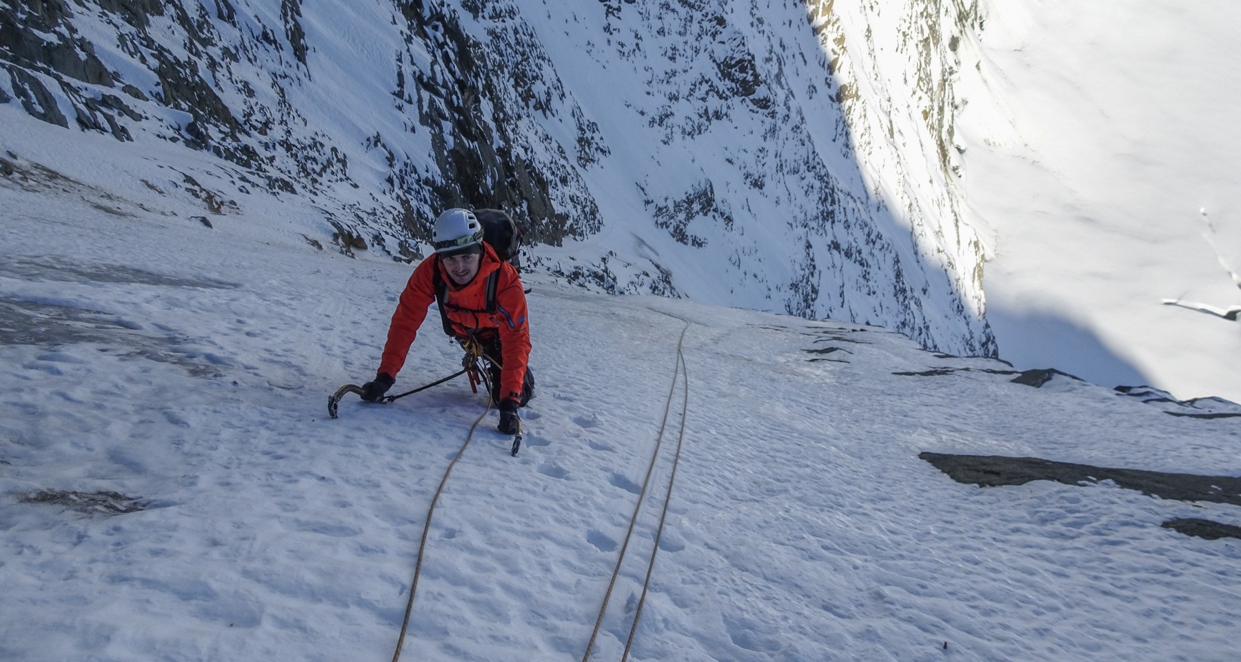
The next day we walk only half an hour to the base of the route. Here could already be the crux in form of a big bergschrund waiting for us. After that we climb up moderate snow and ice to the steep ramp, which usually consists of 60 degree alpine ice for several pitches and is a tru calf burner. Upon reaching the Groegerschneide at the end of the ramp, we still have a long way to the summit via the upper part of the NW ridge (rock climbing up to grade 4- (UIAA scale).
A long decent awaits for us, first via the regular route to the Adlersruhe. From there we can either go down the Hofmannskees back to the Franz Josefs Hoehe, or down the Koednitzkees towards Kals, depending on conditions.
Requirements
very good physical shape, rock climbing and ice climbing experience, no fear of hights, sure footing.
And of course we need very stable weather for this outing.
Dates
Either late fall or spring time usually present the best conditions, in the Summer there is usually too much rock fall hazard.
Please inquire early so we can make sure to secure the best guide available.
You might also like


1/5
Fitness (for all activities)
little fitness = you can hike an elevation gain of 400m up and down, or a total time of 3-4 hours depending on the activity
Technical skills Ski Touring:
easy (up to 30 degrees)=very easy or easy ski tour with a steepness less than 30 degrees. No previous knowledge required. You can parallel ski on groomers. No kick turns required.
Technical skills Ice Climbing:
easy (40-60 degrees)=fairly flat waterfall with small steps, mostly top rope belayed
Technical skills Alpine Climbing:
easy=easy snow slopes, glaciated terrain with some crevasses, pretty much everyone can do this, no previous experience required.
Technical skills Rock Climbing:
easy=easy terrain like scree slopes or blocky ridges with good stances where you need your hands for support. Good for beginners or children.
Technical skills hiking:
T1 hiking=always on a good hiking trail, no fall hazard. No requirements, also possible with running shoes, everyone can do this.
Technical skills Via Ferrata:
K1 very easy=very easy Via Ferrata which is possible for beginners and children.
Technical skills Snow Shoe hikes:
easy with less than 25 degrees=fairly flat, no avalanche hazard. Everyone can do this.
2/5
Fitness (for all activities)
basic fitness = you can hike an elevation gain of 400m to 800m up and down, or a total time of 5 hours depending on the activity
Technical skills Ski Touring:
easy (approx. 30 degrees)=easy ski tour with a steepness around 30 degrees. You can parallel ski on all groomers and can turn off piste. Some kick turns required or other means to make a change of direction in 30 degree terrain.
Technical skills Ice Climbing:
moderate (70-80degrees)=short but steep waterfall steps to almost vertical. You should be able to put your own screws in and build a basic anchor. Basic ice climbing skills required.
Technical skills Alpine Climbing:
moderate=predominantly low apple snow slopes with shorter steep sections, glaciated terrain with crevasses, sure footing required.
Technical skills Rock Climbing:
moderate=climbing routes with sections up to grade 2-3 (UIAA scale), scrambling terrain or steeper scree slopes should be handled with ease. For talented beginners or people with some previous climbing experience.
Technical skills hiking:
T2 mountain hiking=easy hike on a good hiking trail, with shorter steep sections, barely any fall hazard. Possible with running shoes, but proper hiking shoes recommended. some sure footing is helpful. Since those trails are located above treeline, one can run into snowfields early season or washed out sections after lightning storms.
Technical skills Via Ferrata:
K2 easy=Easy Via Ferrata which is possible for beginners and children, but some sure footing and no fear of heights required.
Technical skills Snow Shoe hikes:
easy with less than 25 degrees=fairly flat, some avalanche hazard possible. Everyone can do this.
3/5
Fitness (for all activities)
Good fitness = you can hike an elevation gain of 800m to 1200m up and down, or a total time of 7-8 hours depending on the activity
Technical skills Ski Touring:
moderate (up to 35 degrees)=Moderate ski tour with a steepness up to 35 degrees. Most classic ski tours fall in this category. You can parallel ski in most snow conditions off piste. Kick turns required, experience with ski crampons, and some basic crampon techniques for glaciated sections.
Technical skills Ice Climbing:
moderately difficult (80-90degrees)=short but steep waterfall steps to vertical ice and traverses. You should be able to put your own screws in, build a basic anchor and belay your partner. Good ice climbing skills required.
Technical skills Alpine Climbing:
moderately difficult=steeper snow and ice slopes with the occasional belay, partially heavily crevassed glaciated terrain, small Bergschrunds, mountain experience, basic rope handling and sure footing required.
Technical skills Rock Climbing:
moderately difficult=exposed climbing routes with sections up to grade 3-4 (UIAA scale) over several pitches, scrambling terrain or steeper scree slopes should be handled with ease. Previous rock climbing experience is essential.
Technical skills hiking:
T3 demanding mountain hiking=at times no hiking trail and/or exposed sections, could require holding on to fixed ropes or chains, and/or the use of your hands for balance and support, proper hiking shoes a must. Sure footing and some basic mountain experience come in handy. Since those trails are located above treeline, one can run into snowfields early season or washed out sections after lightning storms.
Technical skills Via Ferrata:
K3 moderately difficult=More exposed and steeper Via Ferrata, sure footing and no fear of heights required.
Technical skills Snow Shoe hikes:
demanding with up to 30degrees=generally moderately steep with short steeper sections, some movement skills and balance helps. Some sections lead through avalanche terrain and need to be managed accordingly.
4/5
Fitness (for all activities)
Very good fitness = you can hike an elevation gain of 1200m to 1500m up and down, or a total time of 10 hours depending on the activity
Technical skills Ski Touring:
demanding (up to 40degrees)=ski tour with a steepness up to 40degrees. A step up from regular ski tours. You are a good, solid skier in most snow conditions off piste. Solid kick turns required, experience with ski crampons, solid crampon technique for glaciated sections, basic rope handling may be required.
Technical skills Ice Climbing:
difficult (90degrees)=consistently steep waterfall ice or long alpine couloirs, at times basic mixed climbing skills are needed. You might encounter sections of bad ice quality. You should be able to put your own screws in, build a basic anchor and belay your partner. Very good ice climbing skills required.
Technical skills Alpine Climbing:
difficult=steep ice slopes with the occasional belay, exposed ridge and face climbing to grade 4 (UIAA scale), partially heavily crevassed and complicated glaciated terrain, Bergschrunds, in depth mountain experience, general rope handling and sure footing required.
Technical skills Rock Climbing:
difficult=exposed climbing routes with multiple sections up to grade 5 (UIAA scale) over many pitches, scrambling terrain or steeper scree slopes should be handled with ease. Previous rock climbing experience of many grade 4 routes is essential.
Technical skills hiking:
T4 difficult mountain hiking=at times no hiking trail and/or exposed sections, steep scree and grass slopes may be crossed. Could require holding on to fixed ropes or chains, and/or the use of your hands for balance and support, proper hiking shoes a must. Some sections may lead over glaciated terrain and bare ice. Sure footing and some basic mountain experience an asset.
Technical skills Via Ferrata:
K4 difficult=Exposed and steep Via Ferrata, sure footing and no fear of heights required. Short, exposed sections without the aid of a steel cable.
Technical skills Snow Shoe hikes:
difficult with over 30degrees=generally moderately angled terrain with longer, steeper sections, maybe involving short rock sections and glaciers. Good movement skills and balance an asset. Some sections lead through avalanche terrain and need to be managed accordingly.
5/5
Fitness (for all activities)
Extremely good fitness = you can hike an elevation gain of over 1600m up and down, or a total time over 10 hours depending on the activity
Technical skills Ski Touring:
difficult (above 40degrees)=ski tour with a steepness above 40degrees. You are a very good, solid skier in all snow conditions off piste. Sections of the tour may lead through a “no fall zone” up and/or down. Solid kick turns required, experience with ski crampons, solid crampon and ice axe technique for glaciated sections and frozen faces, basic rope handling is required.
Technical skills Ice Climbing:
very difficult (90degrees+)=consistently steep waterfall ice with potential rock steps, or long, time-consuming alpine couloirs or faces, mixed climbing skills are an asset. The ice quality might be poor at times. You are able to put your own screws in, build a basic anchor and belay your partner. Very good ice climbing and alpine climbing skills required.
Technical skills Alpine Climbing:
very difficult=steep ice and mixed slopes with continuous belayed climbing, time consuming, exposed ridge and face climbing to grade 4 (UIAA scale) and short sections may be above that grade. Partially heavily crevassed and complicated glaciated terrain, Bergschrunds, in depth mountain experience, good rope handling and a large degree of independent responsibility required.
Technical skills Rock Climbing:
very difficult=exposed climbing routes with multiple sections up to grade 6 (UIAA scale) over many pitches, or short sections above that grade. In depth rock climbing experience of many grade 5 routes is essential.
Technical skills hiking:
T5 very difficult mountain hiking=predominantly no hiking trail and exposed sections, steep scree and grass slopes will be crossed. Will require holding on to fixed ropes or chains, and/or shorter rock climbing sections. Proper hiking shoes a must. Some sections may lead over glaciated terrain and bare ice. Sure footing and good mountain experience an asset.
Technical skills Via Ferrata:
K5 very difficult=Exposed and steep, partially overhanging Via Ferrata, sure footing and no fear of heights required. Short, exposed sections without the aid of a steel cable should be handled with ease.
Technical skills Snow Shoe hikes:
very difficult with over 35degrees=challenging terrain with longer, steeper sections, maybe involving short rock sections and glaciers. Good movement skills and balance a must. Several sections lead through avalanche terrain and need to be managed accordingly.